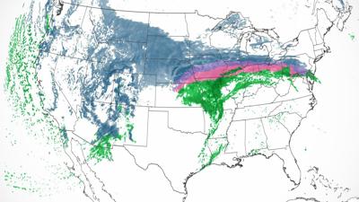
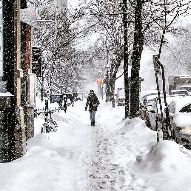
More than 60 million people in 28 states are currently under winter weather warnings due to a significant winter storm that is expected to batter much of the US West and North this week. The storm will bring a mix of heavy snow, rain, and gusty winds.
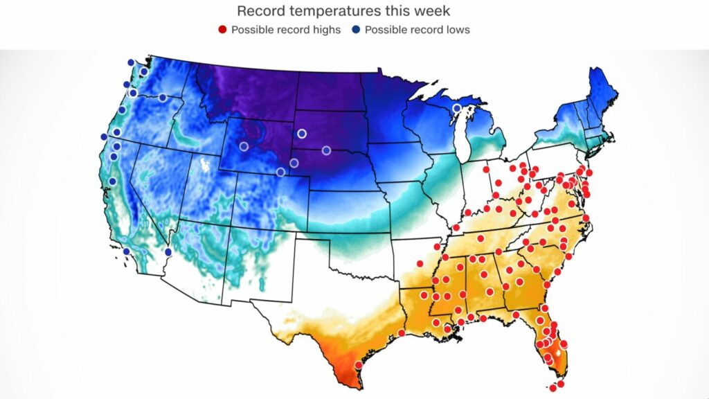
Nearly 150 million Americans will experience a high above 70 degrees this week, but in the Southeast and as far north as the Midwest, it will feel more like early summer. Highs in central Florida will soar into the 90s while highs in the Dakotas will be below zero, creating a stark difference across the nation.
The West Coast, the Midwest, and the shoreline of New England are all affected by the winter warnings. Tuesday’s primary effects are anticipated in the West and Midwest, particularly Minneapolis, where historic snowfall totals by Thursday are possible.

The National Weather Service predicts that most mountain ranges in the West will receive between one and two feet of snow, with some areas potentially receiving even more.
Up to 6 inches of snow is possible in Northern California’s lower altitudes. The weather agency added that interior valleys can anticipate a lighter rain and snow mix.
In addition to the snow, the weather service predicted that wind bursts of 50 to 60 mph and up to 80 mph in some locations would affect much of the West.
The weather agency has issued a blizzard warning for parts of Wyoming, Colorado, South Dakota, North Dakota, Iowa, Minnesota, and Wisconsin.
The blizzard that is anticipated to form from the High Plains through the Upper Midwest, particularly Wednesday and Thursday, may be even more impressive and significant than the snowfall event that will affect the West, according to the Weather Prediction Center.

“By late Tuesday night and more remarkably on Wednesday, the main winter storm will develop and spread tremendous snowfall across the High Plains and Upper Midwest, both in terms of coverage, rates, and amounts.”
On Wednesday, snowfall rates of one to two inches per hour are likely. This will result in blizzard conditions, which will make movement across the area difficult to impossible and may cause power outages, along with strong winds of 40 to 50 mph.
This week’s snowfall in Minneapolis is predicted to be historic, with numerous rounds anticipated to bring accumulation of more than 2 feet and strong wind gusts of 50 mph by Wednesday.
The prediction center cautioned that the storm might rank among Minnesota’s top three snowfall occurrences of all time.
Up to 7 inches of snow may accumulate in Minneapolis during the first round of snow on Tuesday. Another 10 to 20 inches of snow may fall during the second round of precipitation, which is anticipated to start Wednesday afternoon and last through Thursday. Between 18 and 25 inches could be the three-day total.

Overall, the Midwest could receive between 1 and 2 feet of snow through Thursday, with some places potentially receiving more than 2 feet.
Rain is also expected
The Midwest and Plains are expected to experience showers and thunderstorms late Tuesday night into Wednesday as a result of the same system, according to the prediction center. Beginning on Wednesday, the Upper Midwest may also experience significant rains and severe storms.

According to the Storm Prediction Center, there is a slight chance of severe storms, Level 2 of 5, for central and eastern Oklahoma, much of central Missouri, and portions of western Illinois on Wednesday. These regions include Oklahoma City, Tulsa, and St. Louis. Winds that can cause damage and a potential brief tornado are the primary threats.
The slight risk regions are surrounded by a Level 1 of 5 marginal risk for severe storms, which stretches from northern Texas to western Indiana.
From eastern Oklahoma and western Arkansas through Missouri to northern Illinois, southern Michigan, northern Indiana, and northern Ohio, the storms may also deliver significant rainfall.
From northeastern Missouri to southwestern Michigan, where 2 to 4 inches of rain are probable, will likely experience the heaviest rainfall.
Other places had summer-like temps
In the meantime, temps in the Southeast, Tennessee Valley, Ohio Valley, and mid-Atlantic could reach February record highs.

Beginning on Tuesday and peaking on Thursday, the region’s high temperatures will rise into the 70s and 80s, with some towns on the Florida peninsula possibly reaching the 90s. These highs, which are usually recorded in May or early June, are 20 to 35 degrees above average.
More than 130 cities may break daily high temperature marks from Tuesday to Friday, and some, like Atlanta, Orlando, Birmingham, Charlotte, and Richmond, may even do so monthly.
Download The Radiant App To Start Watching!
Web: Watch Now
LGTV™: Download
ROKU™: Download
XBox™: Download
Samsung TV™: Download
Amazon Fire TV™: Download
Android TV™: Download

